

Start screen
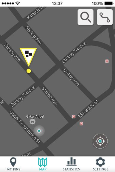
The first screen user sees after opening the Bike Pin application is the map of the area he or she is currently in and explore the data. Displaying the location on the map enables the user to quickly view the area and plan a safer route. Each screen also contains the main navigation menu, which consists of four main menu items: managing and updating pins, viewing the map, visualisation of key statistics and settings.
Each Bike Pin that was submitted and is visible on the map, can be tapped by the user in order find out more details. The user can also ‘support’ the reported pin, a system similar to “likes” used by Facebook, that would encourage users to highlight the most pressing issues. Depending on the amount of people who ‘supported’ the reported danger, each pin will grow in size.
 Reporting system
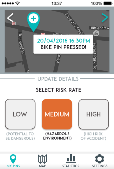
After pressing the Bike Pin device, user would get a notification/reminder to update the details of the danger before the warning is shared.
The process of updating the details of the cause of danger has been designed to be efficient and effective. User goes through an easy selection process, specifying risk level and cause of danger. The causes of danger were narrowed down to three main categories, based on most common types of cyclists accidents. There is an additional option of “other” in case the reported danger does not fit into a specific category.
User is able to review all of the submitted Bike Pins and to adjust the data at any time. This feature was added, in aim to generate dynamic maps, constantly updated by the users.
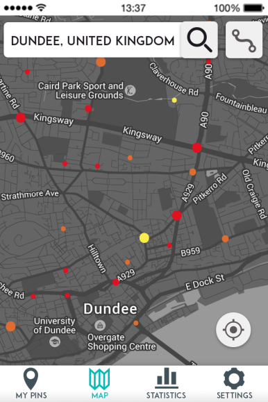
Searching locations
User can explore different locations, and discover the safest areas. The data visualised on the maps has been designed into three stages, with each stage featuring more detail, depending on the level of zoom. Providing an instant access to submitted data is what makes this application stand out from other data gathering systems(which are usually in a form of a standard survey).
 Route planning
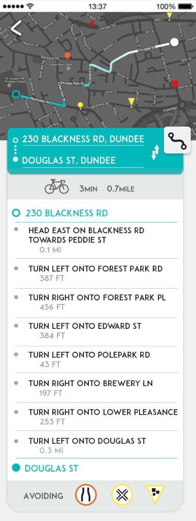
The route planning feature advises the user a safer route choice, by recommending a journey avoiding the most dangerous areas. The most dangerous areas are listed underneath each route plan. Standard information, such as time and distance, are also displayed. The map with dangers reported areas and the route plan is displayed with every route plan.
